skip to main |
skip to sidebar
Today we crossed this bridge over Passamaquoddy Bay to Campobello Island in New Brunswick’s Bay of Fundy.
This Canadian soil has become part of America’s heritage. It is the home of Roosevelt Campobello International Park, created in 1964.
This “cottage”, built in 1897, and now known as the Franklin D. Roosevelt summer home, was purchased by Sara Roosevelt, FDR’s mother, in 1909.
FDR and his family spent summers here from 1909 to 1921, when he was diagnosed with polio at the age of 39.
Originally a schoolroom and play room, the room above became the reception room and office.
The wide living room windows look across the bay to Eastport, Maine.
Most furnishings are original items.
The spacious kitchen has a large coal and wood-burning stove and a smaller kerosene stove. There are also seven wood-burning fireplaces.
Personal laundry was washed at the “cottage”. Linens were sent out to be done.
The master bedroom. Franklin Roosevelt Jr. was born in this room.
Located on a small island off the tip of Campobello Island, the Head Harbour Lightstation is the oldest surviving lighthouse in New Brunswick and one of the oldest in Canada.
Also known as the East Quoddy Light, it was built in 1829 and is still in use today.
It is colored with a distinctive St. George red cross daymark.
A short distance away, in Lubec, Maine, is the West Quoddy Head Light on the eastern-most point of land in the United States.
First built in 1808, and remodeled in 1858 to its present red-and-white tower, it’s light still shines through it’s original Fresnel lens.
Here I am at the Easternmost point in the USA.
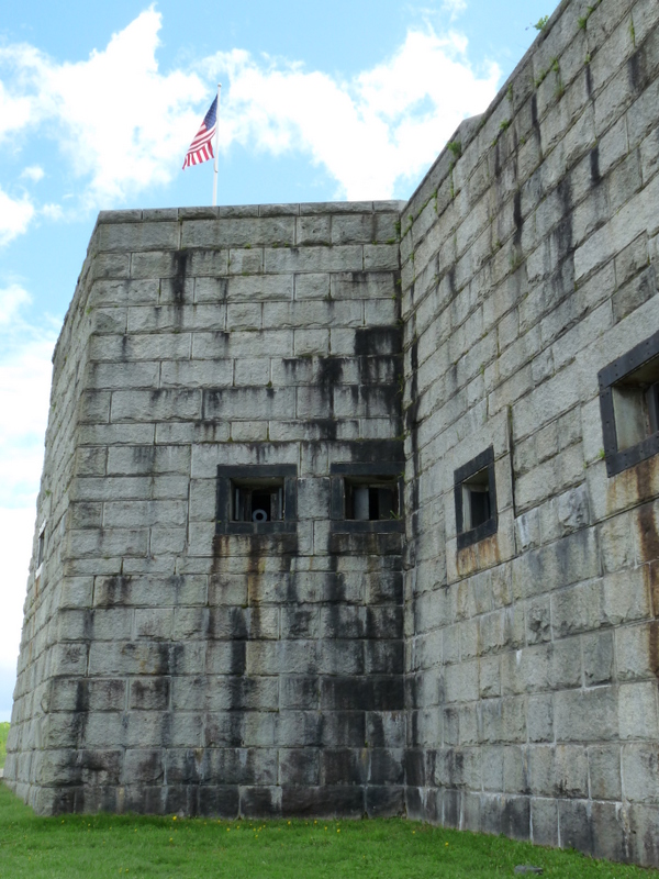
We went back to the Penobscot River Valley today to visit Fort Knox.
It’s two levels contain mounts for 135 cannons in what is the first and largest granite fort built in Maine.
The American Revolution and the War of 1812 brought enemy British ships to the Penobscot River.
During both wars, Great Britain seized control of the river and claimed the surrounding land.
As a result, Fort Knox was built to protect the narrow channel through which all enemy ships traveling upriver would have to pass.
The fort saw two periods of military activity. From 20-54 troops were garrisoned here during the Civil War.
About 575 troops from Connecticut lived at the fort for one month during the Spanish-American War.
No enemy ships ever appeared on the Penobscot during these wars.
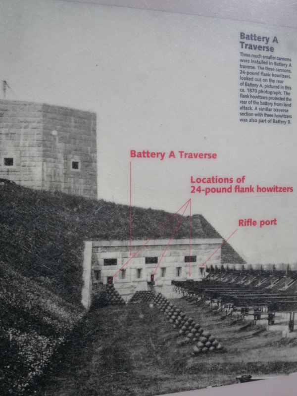
Above is a photo from 1870 showing the same area pictured below.
This 15 inch diameter Rodman cannon was extremely powerful. Twelve men were required to load it. 60-100 pounds of gunpowder was used to fire a cannonball up to 5,579 yards.
This is a hot shot furnace, used to heat cannonballs so hot that when they hit enemy wooden ships , the ships were set on fire.
We found a nice, quiet campsite on a little bay. And guess what’s coming for dinner?
The adventure is over for these two.
No lobster too big, no plate too small. The end of another great day in Maine!
The Penobscot Narrows Bridge and Observatory is the only observatory bridge in the Western Hemisphere and the tallest in the world.
The observatory is, at 420 feet—42 stories, the tallest occupied structure in Maine.
We took a quick ride to the top.
360 degree views are of the Penobscot River and Bay, the Maine countryside and the distant mountains to the west.
The Bayside town of Bucksport, Maine.
We first crossed this bridge 10 days ago on our way to Acadia National Park. On the distant horizon to the right of the bridge, the highest point you see is Cadillac Mountain, where we stood on the highest point on the East coast between Maine and Brazil.
331 miles of epoxy strands(below) make up the cables(above).
Our truck camper is centered far below.
The new bridge on the right opened in 2006 and is 2120 feet long.
It’s much higher than the old one it replaces.
Fort Knox in the distance, guarding the Bay.