After a wonderful Hopi meal, we spent the night camped next to the Hopi Cultural Center on Second Mesa of the Hopi Reservation. This is Hopiland.
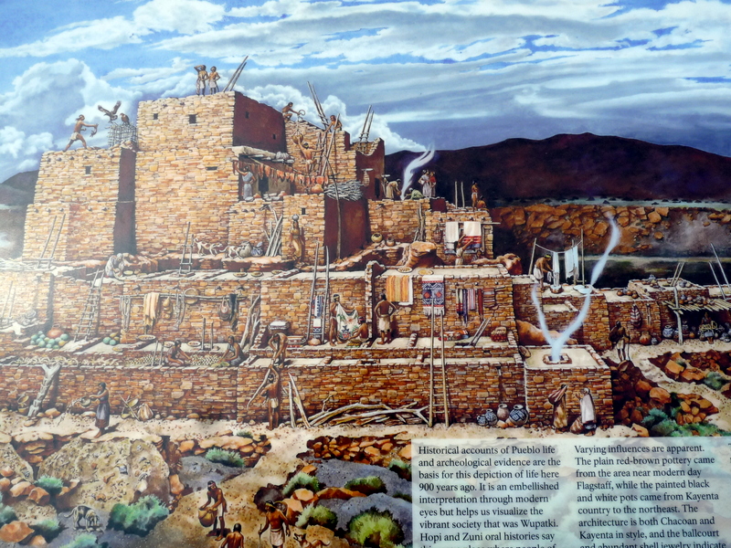
Completely surrounded by the Navajo Nation, here is found the oldest continuously inhabited community in the United States. The first mesa-top villages were settled around 1125 AD.
In the morning we met our guide, who took us to his ancestral village of Mishongovi on Second Mesa, where he still lives.

There are twelve Hopi villages on three mesas with about 10,000 Hopi living here in Hopiland and about 7,000 more Hopi around the world. Few outsiders come here and there are very strict rules for those who do. Our visit would not have been possible without our guide.
We met several villagers and were invited into their homes. We were shown their personal kachina collections and were able to purchase a original kachina from a craftsman in his home.
This is a children's kachina from the Badger Clan.
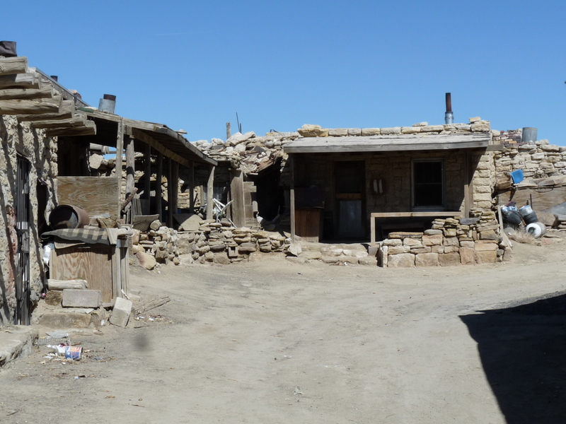
People have continuously lived here in the same ancestral houses clinging to the edges of this rocky escarpment for over 800 years.
Photography is banned, but is limited with a guide. So here are the few pictures we were able to take.
This house belongs to our guides wife's grandmother and has a commanding view of the whole valley below and the distant San Francisco peaks. She has lived here her whole life, as have most of the few remaining villagers.
Judy with our guide Lamar Honyaketewa and the view from his wife's grandmothers house. Lamar is a member of the Bear Clan. The view extends for over one hundred miles.
Holes in the rocks were used for ancient ceremonies, many of which are very unique and are still observed today.
The cemetery on the overlook below. The mesa cliffs abruptly drop 600 feet to the valley below.
A typical home that has been continuously inhabited with almost no change for over 800 years.
The roofs are made of logs, sticks and clay.
Fields of corn, squash, melons and peaches are far below. Wealth here is still measured in how much corn one has. Planting is done by hand with a traditional planting stick, and many prayers and ceremonies take place to insure a good crop.
Water and electricity are very limited, with most homes having none. There are community outhouses and a community well. There is limited propane use, with most homes heated with coal obtained from a distant mine.
Many ancient rituals are still adhered to. The above photo shows clan Kivas with ladders sticking from the roofs. These are occupied by the Kachinas during ceremonies. We hope to come back here to observe a ceremony, and our guide has a parking spot for us! To learn more about the Hopi: http://www.experiencehopi.com.